


4 years, 11 months ago by Scott Hardy
Water has re-closed several roads in Northeast Missouri
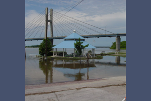
The threat of more rainfall in the area this week means that at Quincy and Hannibal, the Mississippi River could again go over 25 feet later this week.
The latest forecast from the National Weather Service has the river cresting at 25.1 feet at Quincy Thursday morning. At Hannibal, a predicted crest of 25.2 feet is expected Thursday night. At Keokuk, the river will crest at 19.9 feet Thursday morning. At Canton, a crest of 21.3 feet's expected Thursday afternoon, and at LaGrange, a crest of 21.9 feet's also expected Thursday afternoon. Down river at Lock and Dam 22 at Saverton, a crest of 24. 4 feet's expected early Friday morning. At Louisiana, a crest of 23.8 feet's expected early Thursday morning. That's just under the level that would force the Champ Clark Bridge to close.
Three more roads in Northeast Missouri have closed due to the rising flood waters. The Missouri Department of Transportation says that in Knox County, Missouri 151 is closed at the North River, in Monroe County, Route A is closed at Crooked Creek, and in Shelby County, Route N is closed at the North Fork of the Salt River. In addition, a section of Missouri 79 on Louisiana's south side has also been closed, due to water over the road. That section is from North Carolina to Delaware Street. Additional road closures may happen later this week, as the area receives more rain.
To keep up to date with road closures, you're advised to check MoDOT's traveler information map, or gettingaroundillinois.com.